RegCM3
RegCM3 is the third generation of the Regional Climate Model originally developed at the National Center for Atmospheric Research during the late 1980s and early 1990s. The model is supported by the Abdus Salam International Centre for Theoretical Physics (ICTP) in Trieste, Italy. Here, we provide an abbreviated description of the model.
RegCM3 is comprised of a dynamical core (Grell and others, 1995), physics representing radiative transfer (Kiehl and others, 1996), large-scale or dynamic precipitation (Pal and others, 2000), convective precipitation (Grell, 1993), a planetary boundary layer component (Holtslag and others, 1990; Holtslag and Boville, 1993), a biosphere component BATS (Dickinson and others, 1993), representation of open ocean (Dickinson and others,1993; Zeng and others, 1998) and closed water bodies (lakes) (Hostetler and Bartlein, 1990; Hostetler and others, 1993; Small and others, 1999) and atmospheric chemistry and aerosols (Qian and others, 2001). These components are coupled and interactive. Further details of these model components and application of the model can be found in numerous publications (for example, Giorgi and others, 2004a, 2004b, and references therein and Pal and others, 2007, and references therein), the ICTP RegCNET web site (http://users.ictp.it/RegCNET/model.html), and the ICTP RegCM publications web site (http://users.ictp.it/~pubregcm/RegCM3/pubs.htm).
RegCM3 requires time-dependent lateral (that is, vertical profiles of wind, temperature, and humidity) and surface [surface pressure and sea surface temperature (SST)] boundary conditions that are continuously updated every 6 hours of simulation. The lateral boundary conditions derived from GCM output are assimilated into the RegCM3 with exponential decay in space over 12 grid cells around the perimeter of the model domain. Boundary conditions for RCMs are derived by preprocessing saved GCM fields into a standard format that can be read into the model. Virtually all GCM history files differ both in their format and composition so it is necessary to develop specialized preprocessing codes to accommodate GCM-specific output.
BATS
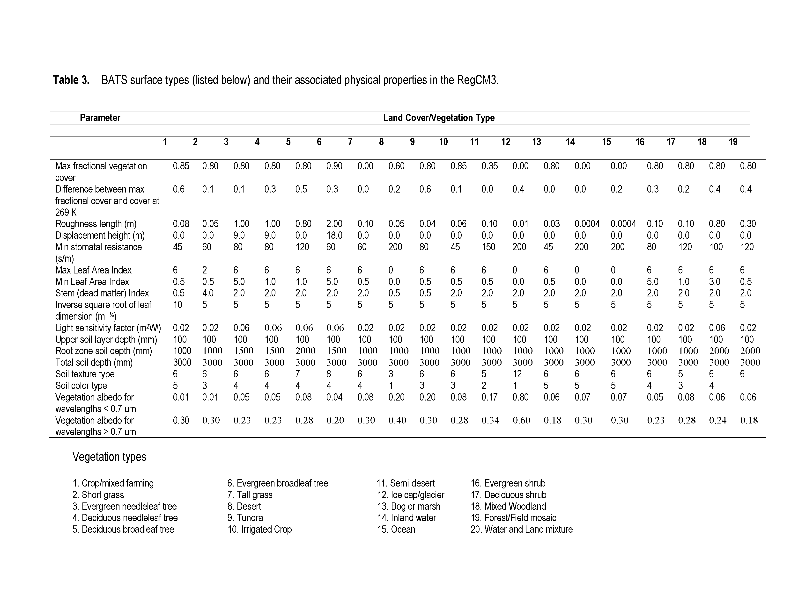
Energy, water, and momentum are exchanged between the surface and atmosphere through the atmospheric boundary layer. The surface is represented by the BATS (Dickinson and others, 1993, figure below) that simulates surface processes related to vegetation (for example, evapotranspiration, leaf temperature, and phenology) and hydrology (for example, soil moisture, runoff, and snow) that vary in response to atmospheric conditions. The soil zone in BATS has a depth of 3 m, which is subdivided into a 0.1 m surface layer and a vegetation-dependent root zone that ranges from 1 to 2 m. Soil moisture and soil temperature are computed. BATS thus provides a large set of variables that are either directly simulated by the model or that can be derived from model output. BATS Surface types and their associated physical parameters are summarized in the BATS Parameter Table.
